|
One
of the motivators behind the Keryx project was to develop
technology that could be used to
bring real-world events into virtual, static environments and bring them
to life. This concept was the inspiration for the Transport Tracker
application during a meeting in 1997 with people from Helsinki Telecom
(now Elisa Communications).
The
Transport Tracker started life as a prototype interface to
the service which would allow users, at home or at work, to monitor the
movements of buses and trams throughout Helsinki in real-time and create
personalised alarms that would inform them when any transport, i.e. bus or
tram, of interest was approaching.
|
 |
At the time, Elisa had a large project
underway called Helsinki
Arena 2000. One of its goals was to provide a user interface metaphor
to next-generation broadband services via a 3D model of the greater metropolitan
area of Helsinki (about 50 sq. km). At the time, this was being used
simply as a glorified 3D web page, with various clickable 3D regions, such as
buildings, being hyperlinked to 2D web pages. With the Keryx Notification
Service, we could enable events to pass between real and virtual environments,
thus adding dynamism to the interface and increasing the range and type of
services that could be offered.
|

click
to enlarge |
|
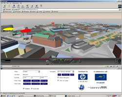
It was decided to take the 3D virtual Helsinki models
being constructed by Arcus Software
and use them to visualise trams moving around Helsinki. A web
browser-based demonstrator was developed using VRML
and Java, installed in Elisa's demo room and used to persuade the
Helsinki Transport company (HKL) to provide access to their real-time monitoring
system. This large (16Mb) video
shows an early version of the 3D user interface with simulated trams
moving around the city model. The user-guide
will give you some idea of the functionality offered.
Some time passed by as I was working on the SmartWeb project and the
progress on the 3D model construction had not progressed as hoped.
After lengthy negotiations between Elisa and HKL, access to the
transport monitoring system had been agreed so in order to progress the
project it was decided to develop a mobile phone version of the
service. |
Finland has an incredibly high penetration of
mobile phone users, around 80%. More of the Finnish population have mobile
phones than credit cards. In mid 1999, the first phones with Wireless
Access Protocol (WAP) were becoming
available. This technology made the user interface necessary to make this
kind of service usable a real possibility. So a plan was created to build
a WAP transport tracking service in the spirit of the original idea.
Implementation began spring 2000 and the system integrated in the autumn of that
year.
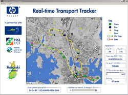
In addition to WAP service, a 2D
visualisation application was also developed to aid in debugging and
also make demos easier! The Real-time Transport Tracker showed the
location of the buses and trams moving around Helsinki on a 2D map in
addition to providing information on expected arrival time at the next
stop, etc.
The pilot service was still running while the
TV advert featuring the service was being filmed in February 2001.
|
|

click to
enlarge |
<%Call PageFooter()%>
|